
Citizens should prepare a plan well in advance of an evacuation. Stay informed about weather conditions and advisories. Know Corpus Christi's hurricane evacuation route maps and contraflow plan.
Evacuation Zone Map »
Evacuation Map Showing Storm Surge from Different Zones »
(This is a large file and may take a few minutes to open.)
I-37 Hurricane Evacuation Lane »
State Evacuation Route Map »
NWS Interactive Storm Surge Map »
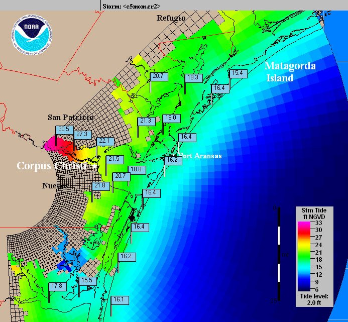
NWS Category 5 Hurricane Storm Surge »
(This map projects the worst case scenario.)